| Back to Workshop Page ... |
Workshop Infos:
Workshop Outputs
| Recommendations |
| Roadmap pdf, html |
| Declaration pdf, html |
| Workshop Report |
| Workshop Summary |
| List of Participants |
| One Page Stories on GRACE |
| Final Roadmap |
| Final Declaration |
| Draft Recommendations |
| Discussion of Drafts |
Supporting Documents:
| 2007 Workshop Report (local copy) |
| 2007 Recommendations |

|
September 30 - October 2, 2009, Graz, Austria |


|
Last edited 03 February 2010
INTRODUCTION
Rationale: The CHAMP and GRACE satellite missions, in orbit since 2000 and 2002, respectively, have significantly improved the spatial resolution and precision of our gravity field models, pushing our knowledge of the static gravity field to centimeter level accuracy in geoid determination. The recently launched European GOCE mission will provide further improvements in accuracy and spatial resolution of the static part of the gravity field. The integration of various satellite missions with geometric techniques such as GPS, SLR and DORIS (monitoring, a.o., changes in the rotation and figure of the Earth), have created new opportunities for the study of mass transport in the Earth system in a globally consistent way. The GRACE mission monitors changes in Earth's gravity field and provides unprecedented insight in water storage changes at sub-continental scales in land water storage, ice sheets and oceans. Oceanographic applications illustrate the unique way in which the combined geodetic observations provide accurate and quantitative constraints on the ocean mass budget, tidal dissipation, near-surface ocean flow and its variability, and large-scale ocean mass variations. The observations are invaluable for understanding the causes of sea level rise and the dynamics of ocean mass redistribution.
Despite the importance of the gravity missions as part of the global geodetic observing system and, in particular, the global water cycle observing system, we are facing a serious challenge in maintaining the observations at current level or increasing spatial and temporal resolution to a level required by many geoscientific applications. GRACE is estimated to cease operation about 2012. If at that time no follow-on mission is launched, the gap in gravity observation would significantly hamper exploitation of the gravity observations for climate studies and the detection of climate change impacts on the global water cycle. It is therefore of paramount importance to come to a global agreement on how sufficient semi-operational satellite gravity missions can be ensured and necessary developments towards increase accuracy, spatial and temporal resolution, and lower latency of products can be facilitated. In parallel, a medium to long-term perspective has to be developed to ensure a continuous and sustainable monitoring of mass transport in the Earth system by means of future gravity satellite missions.
Objectives of the workshop: The workshop aimed at bringing together stakeholders in satellite gravity missions in order to establish a roadmap for future gravity satellite missions that would outline the sensor developments, mission concept developments, and mission implementation, and that would be consistent with anticipations of the major space agencies, CEOS, and GEO, and with the needs of key user groups (such as IGWCO, the GEO Water Tasks, GOOS and GCOS, Earth scientists, and GGOS itself).
In 2007, an international workshop on The Future of Satellite Gravimetry was held (see the Workshop Report) and attended by about 50 leading scientists representing relevant fields of science and technology. The participants agreed on a set of recommendations, which provided the starting point for the roadmap.
Output: It was the goal of the workshop to produce a roadmap document that could be submitted to the GEO Plenary in November 2009 in Washington, D.C., for endorsement and also to the CEOS Plenary and SIT for further discussions. Specifically, the anticipated output of the Workshop included:
- Roadmap for future satellite gravity missions;
- Workshop report on the Workshop Web page;
- Summary report in Episodes;
- A thematic issue of Physics and Chemistry of the Earth.
PROGRAM OVERVIEW
Tuesday, September 29, 2009
| 17:00 - 19:00 | Arrival & Registration |
Wednesday, September 30, 2009
| 0800 - 0845: | Registration & Coffee |
| 0845 - 0900: | Opening and Welcome |
| 0900 - 1040: | Plenary session 1: Status, Requirements, and Challenges |
| 1040 - 1100: | Coffee Break |
| 1100 - 1120: | Introduction to Breakout Sessions |
| 1120 - 1240: | Breakout Sessions: B1: Mission requirements B2: Mission design B3: Data processing, modelling and interpretation |
| 1240 - 1400: | Lunch |
| 1400 - 1540: | Continuation of Breakout Sessions: |
| 1540 - 1600: | Coffee Break |
| 1600 - 1740: | Plenary session 2: Reports from the Breakout Sessions |
| 1900 - 2100: | No-Host Dinner |
Thursday, October 1, 2009
| 0830 - 0900: | Coffee |
| 0900 - 1040: | Breakout Sessions: B4: Integration of mission design, data processing and candidate technology B5: Future products and services B6: Roadmap and Declaration |
| 1040 - 1100: | Coffee Break |
| 1100 - 1240: | Continuation of Breakout Sessions |
| 1240 - 1400: | Lunch |
| 1400 - 1540: | Plenary Session 3: Reports from the Breakout Sessions |
| 1540 - 1600: | Coffee Break |
| 1600 - 1740: | Plenary Session 4: Roadmap and Declaration |
| 1900 - 2100: | Workshop Dinner |
Friday, October 2, 2009
| 0830 - 0900: | Coffee |
| 0900 - 1040: | Plenary Session: The Roadmap |
| 1040 - 1100: | Coffee Break |
| 1100 - 1215: | Plenary Session: Steps towards the implementation |
| 1215 - 1315: | Lunch |
| 1315 - 1515: | Plenary Session: Discussion of roadmap and declaration |
DETAILED WORKSHOP PROGRAM
Tuesday, September 29, 2009
| 17:00 - 19:00 | Arrival & Registration |
WEDNESDAY, SEPTEMBER 30, 2009
| 0800 - 0845: | Registration & Coffee |
| 0845 - 0905: | Opening and Welcome Roland Pail: Introductory comments (presentation) Hans-Peter Plag: Introductory comments (comments) |
| 0905 - 1040: | Plenary session 1: Status, Requirements, and Challenges. Co-Chairs: Roland Pail and Hans-Peter Plag |
| 0905 - 0930: | Douglas Cripe: GEO Tasks and satellite gravity missions (abstract, presentation) |
| 0930 - 0955: | Jay Famiglietti: The global water cycle: where are the main challenges? (abstract, presentation) |
| 0955 - 1025: | Matthew Rodell: Operational applications and future satellite gravity missions (abstract, presentation) |
| 1025 - 1050: | Reiner Rummel: Earth science and future satellite gravity missions (abstract, presentation) |
| 1050 - 1115: | Coffee Break |
| 1115 - 1140: |
National/regional activities related to future satellite gravity missions (For a list of all written reports, see here ...): Isabelle Panet: Future satellite gravity missions (France) (report, presentation) Richard Biancale and George Balmino: MICROMEGA: a CNES project in Phase 0 (abstract, presentation) Jürgen Müller, Nico Sneeuw, and Frank Flechtner: Future Satellite Gravity Missions - Activities in Germany (html, presentation) Federica Migliaccio: Activities in Italy (doc) Cheinway Hwang, B. F. Chao: Activities in Taiwan (doc, presentation) |
ABSTRACTS PLENARY SESSION 1
GEO Tasks and satellite gravity missions
Douglas Cripe
GEO Secretariat, Geneva, Switzerland
The Global Earth Observation System of Systems (GEOSS) is a coordinating and integrating network of Earth observing and information systems, contributed on a voluntary basis by Members and Participating Organizations of the intergovernmental Group on Earth Observations (GEO). The purpose of GEOSS is to achieve comprehensive, coordinated and sustained observations of the Earth system, in order to improve monitoring of the state of the Earth, increase understanding of Earth processes, and enhance prediction of the behaviour of the Earth system. GEOSS will meet the need for timely, quality long-term global information as a basis for sound decision making, and will enhance delivery of benefits to society in multiple areas including, among others, improving water-resource management through better understanding of the water cycle.
Water-related issues addressed by GEOSS will include: precipitation; soil moisture; streamflow; lake and reservoir levels; snow cover; glaciers and ice; evaporation and transpiration; groundwater; and water quality and water use. GEOSS implementation aims to improve integrated water-resource management by bringing together observations, prediction, and decision-support systems and by creating better linkages to climate and other data. With respect to GRACE, GEO can facilitate the linking in-situ water-level observations with remote sensing information such as radar altimetry data and space-borne gravity data to produce products suitable for hind-casting, calibration of hydrometeorological models, water balance estimates, and early warning purposes (i.e. the onset of hydrological drought).
The global water cycle: where are the main challenges?
Jay Famiglietti
University of California, Irvine, USA
While the GRACE time-variable gravity mission has already made several important contributions to terrestrial and global hydrology, many key issues remain unresolved. In this presentation, several of these will be discussed, with implications for the design of a next-generation gravity mission. Examples for discussion include acceleration of the hydrological cycle, water mass changes in Earth’s land, ocean and ice reservoirs, land contributions to sea level rise, and future stresses on surface and groundwater availability. The need for higher space-time resolution information, and for user-friendly data products, will be highlighted, in order to increase the usage of satellite gravity information by the mainstream hydrologic community.
Operational Applications and Future Satellite Gravity Missions
Matt Rodell
NASA Goddard Space Flight Center
Water resources assessments, operational weather and climate predictions, and river flow forecasts, among other applications of societal importance, would benefit from the addition of new or improved hydrological observations. GRACE has proven that terrestrial water storage variations can be derived from a satellite gravimetry mission with enough precision to contribute to water cycle science, and because these observations are independent of the measurements and analyses that normally feed into decision support tools and models, they have the potential to improve water resources management and predictions. This presentation will describe ongoing projects which are attempting to apply GRACE observations for water resources assessments, the challenges faced, and implications for future satellite gravity missions.
Earth Science and future satellite gravity missions
Reiner Rummel
Institute of Astronomical and Physical Geodesy, Technische Universität München, 80290 München, rummel@bv.tum.de
Among of the most important processes related to climate change are the melting of the large ice shields and of the Arctic sea ice, a possible slow down of the Atlantic branch of the global conveyor belt, changes in the global water cycle and in continental water stocks and sea level rise. It is typical to them that they are associated with temporal changes of the oceanic, ice or land surfaces and/or with mass redistribution. Radar and laser altimetry as well as positioning with GNSS proves to be very successful in the determination of geometric surface changes; GRACE is currently providing accurate time series of mass changes, and GOCE is expected to deliver the geoid surface - serving as reference surface of ocean circulation - with very high spatial resolution. This means, geodetic space techniques are capable of providing metric and weight of some of the key climate parameters with very high accuracy.
GGOS is offering the necessary framework for a long-term monitoring of the processes listed above and of geophysical fluids in general. An important requirement is thereby an un-interrupted time series of gravity variations, in the way currently provided by GRACE.
| 1140 - 1200: | Introduction to Breakout Sessions |
| 1140 - 1200: |
Roland Pail: The initial roadmap (presentation) Hans-Peter Plag: Draft declaration and charges to the Breakout Sessions (presentation) |
| 1200 - 1300: | Breakout Sessions: B1: Mission requirements; Co-Chairs: Bert Vermeersen, Victor Zlotnicki; session description; detailed session program. B2: Mission design; Co-Chairs: Juergen Mueller, Stefano Cesare, Nico Sneeuw; session description; detailed session program B3: Data processing, modelling and interpretation; Co-Chairs: Frank Flechtner, Srinivas Bettadpur; session description; detailed session program. |
| 1300 - 1340: | Lunch |
| 1340 - 1540: | Continuation of Breakout Sessions: |
DETAILED BREAKOUT SESSION PROGRAMS
| 1120 - 1540: | Breakout Sessions: B1: Mission requirements; Co-Chairs: Bert Vermeersen, Victor Zlotnicki; session description. |
| 1120 - 1130 | Bert Vermeersen, Victor Zlotnicki: Introduction by session co-chairs and rapporteur (presentation) |
| 1130 - 1200 | Matt Rodell: Hydrology Mission Requirements for a GRACE Follow-On (abstract, presentation) |
| 1200 - 1230 | Henryk Dobslaw, Robert Dill, Maik Thomas: Gravity field signatures of ocean dynamics. (abstract, presentation) |
| 1230 - 1245 | All: General discussion on hydrology and ocean dynamics |
| 1245 - 1400 | Lunch |
| 1400 - 1430 | Holger Steffen, Riccardo Riva, Wouter van der Wal, Bert Vermeersen: GIA Requirements for Future Gravity Satellite Missions – Implications After More Than 7 Years of GRACE Data (abstract, presentation) |
| 1430 - 1500 | Jakob Flury, Reiner Rummel, Nico Sneeuw: Time periods, spatial resolution, and accuracy: from geophysical requirements to mission scenarios (abstract, presentation) |
| 1500 - 1540 | All: General discussion on Mission Requirements, followed by Formulation of Recommendations |
ABSTRACTS BREAKOUT SESSION 1
Hydrology Mission Requirements for a GRACE Follow-On
Matt Rodell
NASA Goddard Space Flight Center
Because satellite gravimetry is the only remote sensing technology able to measure water storage changes below the first few centimeters of the soil column, GRACE is already valuable for hydrological research, despite its low resolution relative to other measurements and other issues. Therefore, even a follow-on mission with identical performance parameters would be scientifically justified. Other factors like cost, technology readiness level, and accuracy limitations due to temporal aliasing are more likely to drive the requirements (though certain space agencies may be more likely to approve a mission that demonstrates a new technology). Nevertheless, it is useful to consider how theoretical improvements in resolution and accuracy would benefit hydrological research. This presentation will provide a preliminary assessment of the potential value to hydrology of such improvements.
Gravity field signatures of ocean dynamics
Henryk Dobslaw, Robert Dill, Maik Thomas
GeoForschungsZentrum Potsdam, Section 1.5: Earth System Modelling, Potsdam, Germany
The vastness of the world's ocean together with the water's opacity for large fractions of the electromagnetic spectrum renders the open seas one of the most undersampled parts of the Earth's system. In analogy to satellite altimetry, continuous observation of the ocean's time-variable gravity field are providing a globally homogeneous picture of ocean bottom pressure, that in principle can be used as a proxy to transfer information to areas and times not properly covered by in-situ measurements.
However, instantaneous observations of ocean mass anomalies are primarily affected by ocean tides and barotropic currents caused by atmospheric wind and pressure forcing. The spatial and temporal variability of these non-periodic variations will be reviewed by means of data from a recent version of the Ocean Model for Circulation and Tides (OMCT), which currently provides the marine part of the GRACE atmosphere-ocean de-aliasing product.
Assuming a sufficiently accurate reduction of these barotropic signals from the satellite observations, gravity observations can be used to infer more subtle dynamic quantities. By means of simulated data, it will be discussed how oceanic mass signals connected to changes in thermocline depth on shallow continental shelfes are generated. The spatial and temporal extent of the associated gravity signals will be assessed and related to potential contaminations due to leakage effects from near-by continental sources as simulated by a global hydrological model.
GIA Requirements for Future Gravity Satellite Missions – Implications After More Than 7 Years of GRACE Data
Holger Steffen(1), Riccardo Riva(2), Wouter van der Wal(2) and Bert Vermeersen(2)
(1)Dept. Geosciences, University of Calgary;
(2)DEOS, TU Delft
Analysis of data of the Gravity Recovery and Climate Experiment (GRACE) satellite mission has clearly identified the long-term mass changes in regions of Glacial Isostatic Adjustment (GIA) such as North America, Fennoscandia, Greenland and Antarctica. After more than 7 years, the determined trends are quite robust. Nevertheless, efforts are needed to isolate the GIA signal from the integral effect of processes in the atmosphere, cryosphere, hydrosphere and geosphere, e.g. hydrological contributions in North America and Fennoscandia and ice mass changes in Greenland and Antarctica have to be removed. This involves high demands on the analysis method, the filtering technique and the reduction as well as combination with other models and data, and there is much debate on which approach is the best.
In Fennoscandia, the GRACE solution fits well to results from terrestrial measurements. The uplift centre is located in the Bothnic Gulf, and the uplift area comprises the Scandinavian Peninsula and Finland. A still unknown contribution arises from hydrology, which cannot be sufficiently separated. This also applies to GIA over Northern America. Recent global hydrology models that have been used for reduction of the hydrological effect, however, have to be revised, as they already show non-negligible differences among each other.
To improve knowledge of GIA for Fennoscandia and Northern America, a prolongation of the gravity time series is definitely necessary as it will improve the separability of secular trends both in GIA and hydrology. In our view, using a follow-on mission with identical performance parameters or a new-technology mission with improvements in resolution and accuracy will allow to distinguish the GIA process from hydrological mass variations. A clear GIA signal will then give insight in Earth's 3D structure, tectonic processes and topographic changes.
Over Greenland and Antarctica, satellite gravity measurements are of crucial importance to determine the mass balance of the ice sheet. However, certainly for Antarctica this requires an accurate knowledge of ongoing GIA, which is hampered by the lack of field evidence to accurately constrain the Antarctic glacial history. In the satellite era, new constraints on GIA can be derived from the combination of gravity measurements with additional datasets, such as altimetry (e.g., ICESat and CryoSat) and GPS measurements. Moreover, on short (years to decades) timescales, GIA is a linear process, while ice sheet mass balance is characterized by periodic signals and possibly experience significant deviations form the secular trend.
Therefore, we think that the main requirements for gravity missions over Antarctica are represented by the continuity of the observations in order to isolate periodic signals and deviations from the secular trend and by the highest possible resolution in order to facilitate the combination with local measurements as those provided by altimetry and GPS.
Time periods, spatial resolution, and accuracy: from geophysical requirements to mission scenarios
Jakob Flury (1), Reiner Rummel (2), Nico Sneeuw (3)
(1)Institut fuer Erdmessung, Leibniz Universitaet Hannover
(2)Institut fuer Astronomische und Physikalische Geodaesie, TU Muenchen
(3)Geodaetisches Institut, Universitaet Stuttgart
Science requirements for the next generation of satellite gravity missions have been discussed since the launch of GRACE. In ESA studies, requirements from all fields of Earth sciences were collected. Results were compiled into synoptic tables and presented in well-known "bubble" diagrams. We will use these results and tables to discuss key geophysical requirements. Discussion will include a comparison with recent findings and lessons from GRACE. Simulated gravity field accuracies will be used to show the potential of mission scenarios such as inter-satellite laser ranging and gradiometry in view of key science requirements.
| 1120 - 1540: | Breakout Sessions: B2: Mission design; Co-Chairs: Jürgen Müller, Stefano Cesare, Nico Sneeuw; session description. |
| 1120 - 1125 | Jürgen Müller, Stefano Cesare: Introduction (presentations |
| 1125 - 1140 | Pete Bender: Future gravity mission scenarios involving two pairs of drag-free satellites (abstract, presentation) |
| 1140 - 1155 | Bryant Loomis: Possible mission architectures for a GRACE follow-on mission including a study on upgraded instrumentation suites, and multiple satellite pairs in moderately-inclined orbits (abstract, presentation) |
| 1155 - 1210 | Stefano Cesare: First developments on laser metrology technologies and drag-free/formation control techniques (abstract, presentation) |
| 1210 - 1225 | Jean-Pierre Marque: The ultra sensitive GOCE Accelerometers and their future developments (abstract, presentation) |
| 1225 - 1240 | Albert Zaglauer: Platform design and technologies for future gravity missions (abstract, presentation) |
| 1240 - 1400 | Lunch |
| 1400 - 1415 | Gerhard Heinzel: LISA Pathfinder technology developments applicable to future gravity missions (abstract, presentation) |
| 1415 - 1430 | Wolfgang Schäfer: Advanced Concepts for Ranging and Time Transfer: Applications and Mission Support (abstract, presentation) |
| 1430 - 1445 | Malte Schmidt: Advanced accelerometer/gradiometer concepts based on atom interferometry (abstract, presentation) |
| 1445 - 1500 | A. Görlitz: Transportable optical clocks: towards gravimetry based on the graviational redshift (abstract, presentation) |
| 1500 - 1540 | General discussion, questions/answers, and session wrap-up/conclusions |
Posters:
| Peter Gath: Long Lifetime Orbits for the German Lunar Exploration Orbiter (abstract, pdf) |
ABSTRACTS BREAKOUT SESSION 2
FUTURE GRAVITY MISSION SCENARIOS INVOLVING TWO PAIRS OF DRAG-FREE SATELLITES
Bender, P. L. (1), Wiese, D. N. (2), and Nerem, R. S. (2)
(1) JILA, Univ. of Colorado and Nat. Inst. of Standards & Technology, Boulder, CO 80309, USA
(2) Dept. of Aerospace Engineering Science and Colorado Center for Astrodynamics Research, Univ. of Colorado, Boulder, CO 80309, USA
In investigating possible scenarios for future Earth gravity missions, it seems useful to consider particularly what can be accomplished with two pairs of drag-free satellites. However, since the GRACE-2 mission is not expected to be drag-free, the performance that hopefully can be achieved with a single pair of drag-free satellites plus GRACE-2 also will be discussed briefly.
Putting two pairs of satellites with laser interferometry between them into polar or near polar orbits does not appear to be the optimum approach. Polar orbits will be considered here for simplicity, although having at least one pair in a sun-synchronous orbit certainly deserves to be looked at also. The well-known weakness of having both pairs polar is that the ground tracks for south-to-north (S-N) and N-S passes only make an angle of 0.13 radians, and thus the W-E gradients in the geopotential at satellite altitude are considerably less well determined than the S-N gradients, if measurement noise is the main limitation. The sensitivity to temporal aliasing also appears to be fairly high.
An alternate approach is to have one pair in a polar orbit and the second pair in an orbit with a moderate inclination I of perhaps 50 to 65 deg. This architecture will be assumed in the rest of this talk. As an example, we will assume 360 km altitude, a repeat ground track after 201 revolutions, and I = 55.8 deg. The repeat period is 12.8 days. This ground track repeat period is considerably less than the 22.7 day period assumed in an earlier study [1]. However, the maximum spacing between ground tracks near the equator is still only 199 km, and this coverage appears to be dense enough so that little information will be lost because of the gaps.
The main argument for putting one pair of satellites in a moderate inclination orbit has to do with short wavelength variations in the satellite altitude geopotential height in the east-west direction. For polar orbits, such variations have to be determined by combining data taken at quite different times, and thus fairly large variations in atmospheric and oceanic mass distribution models at low frequencies can affect the results. For orbits where the crossing angles are much larger over most of the globe, it is only the variations in the short wavelength model errors over the repeat period of perhaps 10 to 15 days that will be important, if the filtering of the data is done properly.
Probably the most important questions concerning this architecture are the effects of temporal aliasing on the results. Some of the effects based on spherical harmonic analysis for missions of this kind will be described in another talk by Bryant et al.. However, the limitations will be discussed in this talk from a local analysis point of view, based on the well-known constant orbital energy approximation. Uncertainties in ocean tide models will not be included, since attention will be focused on land areas not too close to coastlines.
The polar pair of satellites, in addition to filling in coverage of the polar regions, will provide strong ties between the highest latitude parts of the orbit for the moderate inclination pair. The coverage by the moderate inclination pair will be quite dense after only one day for the region within a couple of degrees of the maximum latitude. And the polar pair will give ties between parts of the moderate inclination pair orbit about 12 hours apart in time. Thus the combination will give quite dense coverage for at least a small part of the globe, and thus hopefully minimize temporal aliasing for this region. In view of the short arcs across the poles that are involved, it is possible that the polar pair not being drag-free would not be a serious limitation, although this has not yet been studied.
[1] Bender, P. L., Wiese, D. N., and Nerem, R. S., 2008, "A Possible Dual-GRACE Mission with 90 Degree and 63 Degree Inclination Orbits", in Proc. 3rd Int. Symp. on Formation Flying, Missions and Technologies, 23-25 April, 2008, Noordwijk, The Netherlands, European Space Agency Symposium Proceedings, ESA SP-654.
POSSIBLE MISSION ARCHITECTURES FOR A GRACE FOLLOW-ON MISSION INCLUDING A STUDY ON UPGRADED INSTRUMENTATION SUITES, AND MULTIPLE SATELLITE PAIRS IN MODERATELY-INCLINED ORBITS
Loomis, B. D. (1), Wiese, D. N. (1), Nerem, R. S. (1), Bender, P. L. (2), Visser, P.N.A.M. (3)
(1) Colorado Center for Astrodynamics Research, Dept. of Aerospace Engineering Sciences, Univ. of Colorado, Boulder, CO 80309, USA
(2) JILA, Univ. of Colorado and Nat. Inst. of Standards & Technology, Boulder, CO 80309, USA
(3) Delft Institute of Earth Observation and Space Systems (DEOS) Delft University of Technology Kluyverweg 1, 2629 HS, Delft, The Netherlands
The Gravity Recovery and Climate Experiment (GRACE) has been providing monthly estimates of the Earth’s time variable gravity field since its launch in March 2002. The GRACE gravity estimates are used to study temporal mass variations on global and regional scales, which are largely caused by a redistribution of water mass in the Earth system. The accuracy of the GRACE gravity fields are primarily limited by the satellite-to-satellite range-rate measurement noise, accelerometer errors, and temporal aliasing caused by un-modeled high-frequency variations in the gravity signal. Full numerical simulations are performed for a GRACE Follow-On mission (GFO) to determine if a future satellite gravity recovery mission with improved technologies will provide better estimates of time-variable gravity, thus benefiting many area of Earth systems research.
Several GFO configurations are considered for this study. The first case considered is a two-satellite collinear pair similar to GRACE. The best-case two-satellite mission is equipped with an interferometric laser ranging system and a drag-free system in a lower altitude orbit. The laser ranging system improves the satellite-to-satellite range-rate measurement accuracy to ~1 nm/s as compared to ~1 micron/s for GRACE K-band microwave ranging, and the drag-free system more accurately removes the non-conservative forces acting on the satellites than the GRACE on-board accelerometers. Two “hybrid” missions are also considered. One hybrid is the GRACE design where the K-band ranging is replaced by the laser; and the other is a drag-free, low altitude scenario with K-band ranging. A comparison of simulated gravity estimates is an important design tool in selecting the most important technologies to be considered for a future mission. A method for local time variable gravity recovery through mass concentration blocks (mascons) is used to form simulated gravity estimates for Greenland and the Amazon region for three GFO configurations and GRACE.
Simulation results show that only modest improvement is realized for even the best-case two-satellite mission due to temporal aliasing errors. These errors are caused by high-frequency variations in the hydrology signal and imperfections in the atmospheric, oceanographic, and tidal models which are used to remove unwanted signal. Thus, it is recommended that future research efforts be directed towards reducing temporal aliasing errors.
There are three ways in which temporal aliasing errors can be reduced: 1) improving the atmospheric, oceanographic, and tidal models; 2) co-estimating of certain parameters, such as tidal coefficients; and 3) increasing the sampling frequency of the mission. This study primarily focuses on reducing temporal aliasing errors through the latter by studying architectures with multiple satellite pairs. Several architectures are considered, each consisting of two collinear pairs of GRACE satellites: one in a 5-day repeating polar orbit, and the other in a moderate inclined orbit (~65 degrees) with either a 10-day, 15-day, or 23-day repeating groundtrack. The altitude of each collinear pair is around 300 km, and is assumed to fly drag-free and be equipped with a laser interferometer. Global spherical harmonic solutions are made out to degree and order 150 for the respective duration of the repeating groundtrack (10-day, 15-day, or 23-day).
When compared with a single polar pair of collinear satellites in a complementary repeat orbit (10-day, 15-day, or 23-day), the multiple satellite pairs show a substantial reduction in the level of error in recovering a hydrological signal, with the 15-day repeating groundtrack the favored configuration. Recovering ice mass loss from Greenland and Antarctica shows very little improvement due to less dense coverage in the polar regions. Furthermore, the lower inclined pair of satellites leads to a reduction in the longitudinal striping in the gravity solution due to added east-west sensitivity in the observable.
Finally, an alternate processing methodology is explored which estimates daily low degree and order gravity fields in an effort to reduce the temporal aliasing errors through 2). These low degree and order gravity fields are used to correct the final multi-day solution. Results show improvement at higher degrees and reduced longitudinal striping in the gravity solutions. The reduced striping is due to a reduction in the aliasing-induced striations seen in the gravity solutions. These estimated daily solutions could, in theory, be used to improve the de-aliasing products; however, this concept is not explored here.
First developments on laser metrology technologies and drag-free/formation control techniques
Stefano Cesare (1), Sergio Mottini (1), Fabio Musso (1), Manlio Parisch (1), Gianfranco Sechi (1), Enrico Canuto (2), Marco Pisani (3), Miguel Aguirre (4), Bruno Leone (4), Luca Massotti (4), Pierluigi Silvestrin (4)
(1) Thales Alenia Space Italia, Strada Antica di Collegno 253, 10146 Turin, Italy
(2) Politecnico di Torino, Corso Duca degli Abruzzi 24, 10129 Turin, Italy
(3) Istituto Nazionale di Ricerca Metrologica, Strada delle Cacce 73, 10135 Turin, Italy
(4) ESA-ESTEC, Keplerlaan 1, 2201 AZ Noordwijk ZH, The Netherlands
Since 2003, the European Space Agency has initiated assessment studies and technology developments in preparation of a future space gravity mission based on the Satellite-to-Satellite Tracking technique with laser metrology. Thales Alenia Space Italia has led three of these studies in which, in particular, a first concept of the laser metrology system has been defined and the drag-free, formation and attitude control issues has been investigated.
The distance between the satellites is measured using a Michelson-type heterodyne interferometer fed by a Nd:YAG laser source with 1064 nm wavelength, suitably designed to work at long distances (10 km and larger). A breadboard of the interferometer has been built and tested in laboratory: a measurement noise <1 nm/![]() Hz down to a frequency of 10 mHz has been achieved, in agreement with the specified requirement. The laser metrology system is completed by a device for measuring the orientation and the lateral displacement of the laser beam in the reference frames of the satellites and by a device for the precise pointing of the laser. These devices have been also breaboarded and verified in laboratory, including a closed-loop test of the laser beam pointing mechanism driven by the measurements of the lateral displacement metrology.
Hz down to a frequency of 10 mHz has been achieved, in agreement with the specified requirement. The laser metrology system is completed by a device for measuring the orientation and the lateral displacement of the laser beam in the reference frames of the satellites and by a device for the precise pointing of the laser. These devices have been also breaboarded and verified in laboratory, including a closed-loop test of the laser beam pointing mechanism driven by the measurements of the lateral displacement metrology.
The challenge of the formation control design for this mission consists in keeping the satellite relative motion bounded without interfering with the scientific measurements (the satellites must be “free” to move under the effect of the gravity field to be measured), without degrading the drag-free environment (each satellite must be kept in drag-free condition due to the presence of ultra-precise accelerometers on-board) and minimizing the thrusters use (in terms of dynamic range, propellant consumption). A formation controller capable to fulfill these requirements has been preliminarily defined. Its performances have been verified by means of a high-fidelity numerical simulator implemented by TAS-I and derived from the GOCE End-to-End System Simulator. The possibility of realizing the formation, drag-free, attitude control system needed for such a mission requires the availability of ion thrusters with large dynamic range (~40), in particular if the measurement duration is such to encompass periods of maximum solar activity.
The ultra sensitive GOCE Accelerometers and their future developments
Jean-Pierre Marque (*), Mr. Bruno Christophe, Dr. Bernard Foulon, Mr. Pierre Touboul
Office National d’Etudes et de Recherches Aérospatiales (ONERA), 29 Avenue de la Division Leclerc, BP-72, 92322 Châtillon, France
(*) Jean-Pierre.Marque@onera.fr
By combining satellite Gradiometry with SST-high-low GPS tracking, the ESA GOCE
mission aims to provide a high resolution Gravity Field to the Scientific and Engineering
communities. Continuous 3D GPS tracking of the satellite and compensation of nongravitational
forces, thanks to on–board accelerometers, open the way to the fine measurement
of gravitational gradients at the gradiometer location, at a steady low altitude.
The tri-axes Gradiometer is conceived around six electrostatic accelerometers which are
organised in three orthogonal pairs. The accelerometers were specifically developed to
guarantee a level of noise acceleration as low as  , for a measurement range
of
, for a measurement range
of  .
.
They are based on a similar principle than the ones embarked on GRACE twin satellites but with some design and technical evolution to improve their resolution by two orders of magnitude and to satisfy the specific gradiometric requirements.
Their contributions to the mission is double by providing, on one side, the drag-free and attitude control system with the linear accelerations of the satellite and, on the other side, by delivering the scientific data to be on-ground processed to extract the GGT components. The GOCE satellite was launched on March 17, 2009 from Plessetsk in Russia and the Gradiometer was switched on the 8 of April 2009, in science mode.
The paper will present the main characteristics of the accelerometers and the preliminary data, obtained after the first months in orbit, illustrating the in-flight behaviour of the six accelerometers. The future accelerometer developments for the gravity mission of the next generation will be presented focusing on trade-offs betweens sensors, satellite requirements and in orbit configuration.
The accelerometers of the GOCE mission have been developed by ONERA under contract with ESA through Thales Alenia Space as Prime Contractor of the mission.
Platform design and technologies for future gravity missions
Albert Zaglauer, Dr. Andreas Rathke, Trond Dagfin Krovel
Astrium GmbH, Friedrichshafen, Germany
Astrium GmbH was responsible for the satellite platform design and development utilized for the gravity missions CHAMP, GRACE and GOCE. All three platforms are still operational in orbit and represent more than 16 years of mission lifetime. As Astrium engineers are still involved in mission support concerning platform aspects and as Astrium is involved in lesson learned processes with the users a wealth of knowledge exists, allowing to support future mission designs.
The feed back by the scientific users is analyzed and translated into requirements and design guidelines down to platform equipment level. Computer models are established allowing parametric study on improvement potential with respect to performance parameters.
The key areas of improvement are identified in the field of AOCS design allowing a "smoother" flight and in the field of structural, thermal hardware reducing "seismic" effects on scientific accelerometer instruments.
LISA Pathfinder technology developments applicable to future gravity missions
Gerhard Heinzel
Max-Planck-Institut für Gravitationsphysik
The LISA mission, a joint ESA-NASA project to be launched around 2020, is designed to observe gravitational waves of astrophysical origin. The necessary techniques, which are under intensive development now, include the control of drag-free spacecraft, free-floating test masses and low-noise heterodyne laser interferometry between distant spacecraft, in a frequency range between 0.1 mHz and 1 Hz. Many of these techniques could also be applied to improve the inter-spacecraft ranging in a GRACE-type mission with slightly different, and often easier, requirements. This presentation will introduce some of the interferometric techniques under development for LISA and its technology demonstrator LISA Pathfinder, and the particular challenges for an GRACE-like application, namely the laser frequency stabilisation and how to deal with orientation jitter.
Advanced Concepts for Ranging and Time Transfer: Applications and Mission Support
Wolfgang Schäfer TimeTech GmbH, Curiestrasse 2, 70563 Stuttgart, Germany
Significant advances have been achieved in the past 30 years in the fields of satellite ranging, time transfer and relative positioning of S/C. Technical drivers are GNSS, deep-space missions and precision metrology based on high performance frequency generation and accurate frequency-, time- and time-interval measurements. Ranging at cm-level stability, time transfer at sub-ns uncertainty and velocity measurements at the µm/s level can be readily achieved using standard technologies. These numbers could be improved by 2 or 3 orders of magnitude using state-of-the art developments and systems.
Major recent achievements are in the fields of ground- and space-based oscillators and clocks, time-keeping and time transfer. Besides traditional microwave-based links, high data-rate optical links will soon emerge. Interesting new capabilities and performance levels arise from the combination of time transfer and ranging results, which can be generated simultaneously using the same bi-directional link and equipment.
Actual standard ground- and space-based equipment is unlikely to cope with these advances and scientific needs in the foreseeable future (i.e. to 2040). This restricts achievable performance for most standard missions to traditional performance levels. More ambitious missions have to rely on dedicated and costly proprietary systems to match their needs. Such systems are often considered experimental rather than operational.
This presentation will identify a range of capabilities and possibilities arising from an integrated approach to combine available and existing technologies and installations to achieve improved overall performance, even under operational conditions. Examples are given, how advanced elements like clocks, data links, etc. could be added at low risk, using readily available measurement techniques.
The goal of this systems approach is a minimum impact and risk on existing installations and to avoid costly duplication of hardware. Science applications and mission operations will profit from continuously available ranging and time-transfer data, which will be generated without major impact on regular S/C operations and TM/TC activities.
Advanced accelerometer/gradiometer concepts based on atom interferometry
M. Schmidt, A. Senger, M. Hauth, S. Grede, C. Freier, A. Peters
Humboldt Universität zu Berlin, AG Optische Metrologie, Hausvogteiplatz 5-7, 10117 Berlin, Germany
Since 1992, matter wave interferometry has been used in many laboratories for a variety of fundamental physics experiments, e.g. measurement of the fine-structure and gravity constants. However, due to the complexity of these experiments, they were confined to laboratory environments. In recent years, however, efforts have been undertaken to develop mobile atom interferometers. These new sensors open up the possibility to perform on-site high-precision measurements of rotations, gravity gradients as well as absolute accelerations.
We present the basic principles underlying atom interferometers. Furthermore, we report on the status of different projects that are currently investigating and testing possible applications of mobile atom interferometers. These possibilities include earthbound mobile gravimeters as well as future employment of this technology in earth observation satellite missions. Finally, we discuss a variety of possible sensor configurations for earth orbit gravity measurements in GRACE / GOCE follow-up missions.
Transportable optical clocks: towards gravimetry based on the graviational redshift
A. Görlitz(1), P. Lemonde(2), C. Salomon(3), S. Schiller(1), U. Sterr(4), G. Tino(5) and the SOC team
(1) Univ. Düsseldorf,
(2) SYRTE Paris,
(3) ENS Paris,
(4) PTB Braunschweig,
(5) Univ. Firenze & LENS
The frequency difference between atomic clocks located at different locations in a gravitational field is fundamentally determined by the difference in gravitational potential. With the new generation of atomic clocks now under development, optical atomic clocks, it should be possible to achieve an equivalent height resolution at the 1 cm level. This type of measurement is a local measurement, complementary to the well-established satellite gravimetry approach. A useful implementation would be a reference optical clock on a satellite, to which a network of (transportable) optical clocks on the ground are compared. Transportable optical clocks demonstrators based on ensembles of neutral atoms in an optical lattice are under development within an ESA/DLR-sponsored project, as a first step towards space clocks. The status and perspectives of the project will be presented.
Long Lifetime Orbits for the German Lunar Exploration Orbiter
Peter F. Gath
ASTRIUM GmbH Satellites, Friedrichshafen
In the context of the German Lunar Exploration Orbiter mission LEO, one mission objective is the improvement of the lunar gravity field models. Current models are based on tracking data from the very first lunar probes, the Apollo program, and more recently the Lunar Prospector mission. A comparison of the historic lunar gravity models with the more recent models that include the Lunar Prospector data reveals large differences in the zonal harmonic coefficients. The largest errors that are contained in the current gravity field models occur on the backside of the Moon due to missing ranging data.
In order to achieve a significant improvement, a pair of satellites forming a GRACE-like constellation is considered as one element of the LEO mission. Such an approach can significantly improve the orbit modeling on the far side of the Moon. In order to obtain a global coverage for the gravity field, the satellites need to fly in a low altitude polar orbit around the Moon. Due to the asymmetry in the Moon's gravity field, such orbits are known to be highly unstable due to a large disturbance that changes the eccentricity vector and thus leads to a deformation of the orbit which ultimately yields a crash of the satellite into the Moon's surface.
In the context of the LEO Phase 0 and A studies, a range of almost polar orbits with an average altitude of 50 km were identified which exhibit a good stability and long lifetime. Such orbits are known as frozen repeat cycle orbits since their average eccentricity vector is not changing and their ground track is repeating. Due to the very slow rotation of the Moon, the repeat cycle is at least one lunar month (approx. 28 days). As illustrated in Figure 1, the eccentricity vector is changing during this period, but the pattern is closed after one lunar month. The same applies for the ground track. A 3D representation of the orbit is shown in Figure 2 with the altitude scaled by a factor of 40. The orbit is designed for a nominal lifetime of 4 years. It was analyzed in more detail with a Monte Carlo simulation in which the different gravity field parameters were varied according to the reported accuracies in the lunar gravity field model. It turns out that a lifetime of at least 100 days can be guaranteed in the presence of the assumed uncertainties and that a the chances of surviving a full year are around 80% if no orbit maneuvers are applied (see Figure 3).
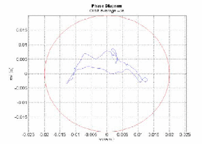
Figure 1: Eccentricity vector diagram for the baseline reference orbit shown for one lunar month
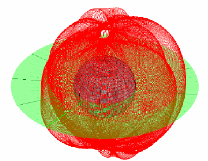
Figure 2: 3D representation of the reference orbit (altitude scaled by a factor of 40)
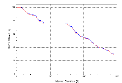
Figure 3: Survival rate of the LEO reference orbit without orbit maintenance applied
The mission lifetime can be extended by applying eccentricity vector correction maneuvers at least once per lunar month and an inclination correction maneuver approximately every 10 lunar months. The inclination correction maneuvers become necessary due to changes in the Moon's rotational axis orientation which effectively yields a small change in the ground track and thereby in the inclination w.r.t. a coordinate frame that is fixed to the Moon's current rotational axis. An extensive analysis was carried out for LEO's main satellite for which a lifetime of four years must be guaranteed. This results in a fuel consumption of approx. 1.1 m/s per lunar month. Of course, the lifetime of the sub-satellites performing the gravity field measurements could also be extended by using the same approach, depending on the fuel that is finally available for orbit maintenance maneuvers. However, the number of maneuvers for the gravity mission should be minimized in order not to disturb the measurements too often. In conclusion, a reference baseline orbit has been found that is suitable for gravity field measurements that allow for a global coverage of the Moon's gravity field and require no orbit maintenance for the first 100 days.
| 1120 - 1540: | Breakout Sessions: B3: Data processing, modelling and interpretation; Co-Chairs: Frank Flechtner, Srinivas Bettadpur; session description. |
| 1120 - 1130 | Frank Flechtner: Introduction (presentation) |
| 1130 - 1145 | Jürgen Kusche: Methodological aspects related to gravity analysis from future missions (abstract, presentation) |
| 1145 - 1200 | Tonie van Dam: Can geodetic data be used as a complement to satellite gravity data in the future? (abstract, presentation) |
| 1200 - 1215 | Pascal Gegout: Background models used in geodetic data processing (abstract, presentation) |
| 1215 - 1230 | P.L. Bender and D. N. Wiese: Local analysis approach for short wavelength variations in the geopotential (abstract, presentation) |
| 1230 - 1240 | All: Summary of recommendations |
| 1240 - 1400 | Lunch |
| 1400 - 1540 | all: Discussion and preparation of summary |
ABSTRACTS BREAKOUT SESSION 3
Not presented:
Local vs Global Methodologies for Gravity Recovery: A GRACE Perspective
F. G. Lemoine, D. D. Rowlands, S. B. Luthcke, J. P. Boy, T. J. Sabaka, R. D. Ray, S.C. Han
The recovery of time-variable gravity from a GRACE-type measurement system poses challenges. The desired signal (usually taken to be hydrology, the cryosphere, ocean mass, or the solid earth) is embedded in other high-frequency signals such as the atmosphere, high-frequency variations in the oceans, and ocean tidal variations. The approach to recover these mass variations has been to forward model as best as possible these ‘extraneous’ mass variations. Herein we concentrate on the methodology of recovering the time-variable signal. We compare a local recovery (mascons) using embedded spatial constraints with a global recovery using unconstrained spherical harmonics and show the advantages of this approach. We illustrate how appropriate forward modeling can reduce the aliased signal and leakage appearing in the gravity solutions, regardless of technique. We provide a brief update on tidal modeling in the era of GRACE and show how even a GRACE spherical harmonic time series can still provide a useful time series of the low degree coefficients, such as C_20. Finally we offer a perspective on the resolution of geophysical signals, with a view of what a future GRACE-Follow-On mission might attempt to recover.
Methodological aspects related to gravity analysis from future missions
Torsten Mayer-Gürr, Annette Eicker, Enrico Kurtenbach, Jürgen Kusche
Institute for Geodesy and Geoinformation, Bonn University
Experience with CHAMP and GRACE has shown that ‘alternative’ methodologies to process orbit and inter-satellite ranging data to gravity field models are competitive to the conventional dynamic method. We expect this will be the case for data analysis from future (i.e. GRACE-FO) missions as well. After a brief review on the ‘Bonn method’ (that essentially solves a series of temporal boundary value problems for an orbit or for inter-satellite observables, instead of initial-value problems), its implementation and current results, we will discuss aspects related to future missions where the data will be of even higher accuracy.
Can geodetic data be used as a complement to satellite gravity data in the future?
van Dam, T.
University of Luxembourg, Luxembourg
Terrestrial and space geodetic data are sometimes used to address spatial and temporal sampling deficiencies in dedicated gravity missions. The most obvious example is the contribution of space geodesy to determining degree-1. Other examples include degree-2 from SLR (which is peculiar to GRACE data usage) and the more general use of extracting a load from observed surface displacement.
As we move towards longer time-series and towards more precise gravity missions, the requirements on these types of space geodetic data products will change. This presentation will attempt to address a few questions regarding the future role of space geodetic data as a complement to dedicated gravity missions including: What are the realistic prospects for improving the supplementary space geodetic data? What areas need work to make this happen? What are the significant challenges?
Background models used in geodetic data processing
P. Gegout (1), F. Lyard (2), J.-M. Lemoine (3)
(1) DTP/GS (2) LEGOS (3) CNES/GS, Observatoire Midi-Pyrenees, 14, avenue Edouard Belin, 31400 Toulouse
The atmosphere, non-tidal oceans and hydrological variations fall into a class of models that can only be represented in empirical time-series; and are generally not used in a predictive sense in geodetic data processing. There are several notable common attributes of these series that affect their use in geodetic data processing. Their quality depends on location. They are outcomes of non-geodetic activities, so the attributes important for their use in geodesy are not always safeguarded (e.g. continuity, uniformity of standards, or long-term trends). This presentation surveys what we know of these issues as relevant to geodesy, and examines the contrast between the availability and the requirements for future gravity missions.
LOCAL ANALYSIS APPROACH FOR SHORT WAVELENGTH VARIATIONS IN THE GEOPOTENTIAL
Bender, P. L. (1), and Wiese, D. N. (2)
(1) JILA, Univ. of Colorado and Nat. Inst. of Standards & Technology, Boulder, CO 80309, USA
(2) Dept. of Aerospace Engineering Science and Colorado Center for Astrodynamics Research, Univ. of Colorado, Boulder, CO 80309, USA
The value of global spherical harmonic analyses for determining 15 day to 30 day changes in the Earth's gravity field has been demonstrated extensively using data from the GRACE mission and previous missions. However, additional useful information appears to be obtainable from local analyses of the data. A number of such analyses have been carried out by various groups. In the energy approximation, the changes in the height of the satellite altitude geopotential can be determined from the post-fit changes in the satellite separation during individual one-revolution arcs of data from a GRACE-type pair of satellites in a given orbit. For a particular region, it is assumed that the arcs crossing that region during a time T of interest would be used to determine corrections to the spherical harmonic results. The shortest wavelengths that can be determined are the most important for investigating the spatial distribution of mass changes with high resolution.
While the longer wavelength variations are affected by mass distribution changes over much of the globe, the shorter wavelength ones hopefully will be determined mainly by more local changes in the mass distribution. The method of putting together results from different arcs crossing the region of interest with the energy approach has been used frequently before. It can be referred to as along-track analysis. The advantages of this approach can be seen most easily for an orbit with moderate inclination, such that the crossing angle between south-to-north (S-N) and N-S passes is fairly large over most regions well away from the poles. In that case, after filtering to pass the shorter wavelengths, the results for a given time interval can be combined to give the short wavelength W-E variations in the geopotential efficiently.
Questions have been raised about the effectiveness of local analyses, since changes in the geopotential at satellite altitude over a given region come from mass distribution changes over the whole globe. But, the main issue in considering higher measurement accuracy in future missions is how much improvement in spatial resolution can be achieved. For this, it is the shortest wavelengths in the geopotential spatial variations that are most important. To check on the effects of local versus global mass distribution changes, some preliminary calculations have been carried out for a roughly 2,000 by 2,000 km region in western and central North America. The results from these calculations indicate that most of the variations for wavelengths less than 1400 km will come from mass changes in the region considered.
Future missions are expected to have much higher accuracy for measuring changes in the satellite separation than GRACE. However, how large an improvement in the derived results in hydrology will be achieved is still very much a matter of study, because of the uncertainty in time variations in the atmospheric and oceanic mass distribution. To be specific, we will assume that improving the spatial resolution is the top objective, the satellite altitude is in the range of roughly 300 to 360 km made possible for long missions by drag-free operation, and ask first what information can be obtained for a single pass across a given Gaussian disk of water.
This single disk measure of performance is clearly much too optimistic because it ignores the complication of not knowing the geometry of the water distribution in the rest of the area of interest. However, it appears to give some insight into the spatial resolution issue, pending further studies. The major limitation is that the wavelengths of the variations in the satellite separation depend mainly on the altitude, until the half-thickness radius R of the disk becomes comparable with the altitude. Thus the measurement accuracy necessary in order to determine R is considerably higher than to just determine the total mass of the disk.
Some preliminary and approximate results will be given for both K-band and laser interferometer distance measurement systems, with and without some atmospheric mass variation uncertainty included. Although these results have been obtained only for a single pass across the region of interest, similar results for crossing S-N and N-S paths can be combined to give the short wavelength W-E variations when the crossing angles are fairly large. But more complete studies including information on expected patterns in the spatial distribution of the hydrological mass changes certainly are needed. A preliminary model probably would be uniform water depth changes in individual river basins. However, it is hoped that the resolution would be high enough to detect something like different changes in different distance ranges from the midlines of the basins, at least for the larger basins.
| 1540 - 1600: | Coffee Break |
| 1600 - 1630: | Plenary session 2a: Reports from the Breakout Sessions. Chair: Isabelle Panet, Jay Famiglietti |
| 1600 - 1610: | Radboud Koop: Report from Breakout session B1 (presentation) |
| 1610 - 1620: | Nico Sneeuw: Report from Breakout session B2 |
| 1620 - 1630: | nn: Report from Breakout session B3 |
| 1630 - 1800: | Plenary session 2b: The Space Agencies: Programs and Boundary Conditions. Chair: C.K. Shum, Reiner Rummel |
| 1630 - 1645: | Steven Hosford: Can we achieve GRACE data continuity? France’s contribution (abstract, presentation) |
| 1645 - 1700: | Yun-Kau Lau et al.: A Satellite Laser Interferometry Gravity Mission Study (abstract, presentation) |
| 1700 - 1715: | J. Ping et al.: Gravity field missions: Status and studies for future missions (abstract, presentation) |
| 1715 - 1735: | Michael Watkins: NASA's plans (abstract) |
| 1735 - 1755: | Roger Haagmans: ESA's plans (abstract, presentation) |
| 1755 - 1800: | All: Any further comments |
| 1900 - 2100: | No-Host Dinner |
ABSTRACTS PLENARY SESSION 2
Can we achieve GRACE data continuity? France’s contribution.
S. Hosford (1), R. Biancale(1), G. Balmino(1), S. Bruinsma(1), A. Laurens(1), M. Diament (2), I. Panet(2)
(1) CNES, 18 avenue Edouard Belin, 31401 Toulouse, France (e-mail: steven.hosford@cnes.fr,
(2) Institut de Physique du Globe de Paris, Géophysique spatiale et planétaire - Bâtiment Lamarck, Case 7011, 5 rue Thomas Mann, 75205 Paris Cedex 13, FRANCE
As a contributor to geophysics missions over the past 15 years, the French space agency (CNES) has a long established procedure for deciding missions in response to the needs of the national scientific community defined during regular "Future Missions Workshops." Following a short description and history of this process, the priority missions resulting from the latest such workshop which took place in Biarritz in March 2009 will be briefly described. In the context of the French national space budget where bilateral missions are now the norm, we will discuss the potential for international collaboration on a future gravity mission and the steps being taken in France and by CNES to facilitate this.
A Satellite Laser Interferometry Gravity Mission Study
Yun-Kau Lau
Institute of Appl. Maths., Chinese Academy of Sciences, Beijing, China.
On behalf of the Space Advanced Gravity Measurements (SAGM) working group. Current member institutes:
Academy of Mathematics and System Sciences, CAS,
CAS Nanocenter, Beijing,
Dong Fang Hong Satellite Company,
Huazhong University of Science and Technology,
Institute of Atmospheric Physics, CAS,
Institute of Mechanics, CAS,
Institute of Physics, CAS,
Shanghai Engineering Center for MicroSatellites, CAS,
Wuhan Institute of Geodesy and Geophysics, CAS,
Wuhan Institute of Physics and mathematics, CAS.
This presentation outlines an ongoing, informal feasibility study of a low-low satellite-to-satellite laser interferometry tracking scientific satellite mission to map the Earth’s temporal gravity field within the Chinese microgravity community. This prospective mission is planned to be launched after the NASA/DLR Gravity Recovery and Climate Experiment (GRACE), or concurrent with or after the scheduled NASA GRACE Follow on mission. Unlike the current GRACE mission, we intend to use two co-orbiting drag-free satellites with laser ranging in place of microwave ranging to enhance the precision of satellite-to-satellite tracking measurement, to infer and to measure variations of the Earth’s gravity field. The scientific justification of the satellite mission includes but not limited to, quantification of the Asian continent and global hydrology, co-seismic and post-seismic deformations resulting from earthquakes and continental geodynamics, and observables driving or resulting from global climate change. At present, the preliminary baseline design parameters under consideration include: (1) the distance between the two co-orbiting spacecrafts: 50–100 km, (2) the precision of the laser interferometric measurement: 1–10 nm, (3) the altitude with drag-free control: 300–350 km, (4) the residual acceleration: 10-10 to 10-12 ms-2(![]() Hz)-1 at around 0.1 Hz, and (5) nominal mission time: four to five years. In-depth instrument error analysis being conducted includes laser metrology, pointing stability and development of reference sensors. Sensitivity analysis is ongoing and one of the critical issues being addressed is the temporal aliasing of signals from errors from background forward models (for example, barotropic atmosphere and ocean responses and tides) as well as the desired signals to be measured. With potential international collaborative partners, collectively one could address of feasibility of formation flights or optimal constellations involving two or even three pairs of GRACE-type satellites to significantly minimize observability, temporal or spatial aliasing problems.
Hz)-1 at around 0.1 Hz, and (5) nominal mission time: four to five years. In-depth instrument error analysis being conducted includes laser metrology, pointing stability and development of reference sensors. Sensitivity analysis is ongoing and one of the critical issues being addressed is the temporal aliasing of signals from errors from background forward models (for example, barotropic atmosphere and ocean responses and tides) as well as the desired signals to be measured. With potential international collaborative partners, collectively one could address of feasibility of formation flights or optimal constellations involving two or even three pairs of GRACE-type satellites to significantly minimize observability, temporal or spatial aliasing problems.
A brief introduction about promoting geo-gravity survey and satellite geo-gravity in China
Ye S.H. (1), Ping J.S. (1), Hu X.G. (1), Shen X.H. (2), Li H. (3),Wang J.S. (4), Wu Y. (3), and Others (5)
(1) Shanghai Astronomical Observatory, CAS
(2) China Earthquake Administration
(3) Hubei Earthquake Administration, CEA
(4) Satellite Weather Research Center, CMA
(5) Prospective Additional Team Members from Other AgenciesShanghai Astronomical Observatory, CAS
Satellite geodetic and remote sensing techniques have been routinely used and play important roles in weather forecasting, surveying resources and monitoring/mitigating natural hazards in China. These satellites include meteorological satellites, the oceanographic satellite (HY-2) and another geodetic satellite, which are scheduled to launch in 2010. The Chinese Academy of Sciences (CAS), in potential future collaborations with other agencies, has identified a wide range of scientific rationales and applications within China and globally which requires a long range planning of satellite geodetic and remote-sensing missions, including satellite gravity missions. One such program is China’s Geo-Hazards Monitoring Program. Under the framework of this Program, the planned satellite missions include the electromagnetic satellite mission to monitor space weather, to study co-/post-seismic earthquake signals, and to explore the feasibility of the potential detectability of earthquake pre-cursor signals; as well as a near-infrared remote sensing satellite for geo-hazard imaging. A GRACE-type satellite gravity mission with enhanced accuracy and spatial resolution directly addresses some of the objectives of the Geo-Hazards Monitoring Program.
The overall identified scientific rationale for a long-term plan for gravity mapping satellite missions include, but not limited to, the efficiency, accuracy and potential timeliness from such global gravity field mapping satellites, the monitoring and potential mitigations of geo- and environmental hazards, the accurate observables enabling monitoring and quantification of anthropogenic climate change, water balance budget and water resource availability, especially within China. This presentation include the articulation of scientific interest within the Chinese scientific and other community to take part or to undertake GRACE-type satellite gravity field mission, and a first-cut plan for a possible roadmap and mechanism to support the realization of a GRACE Stop-Gap mission in the appropriate time frame to minimize data loss between GRACE and GRACE follow-on missions. The plan includes the following up of the Workshop Roadmap to discuss with international partners including the US, Germany, France and others to potentially realize a GRACE Stop-Gap mission or a GRACE Stop-Gap constellation mission, on: (1) a possible offer of a couple of 10–12 m radio tracking ground support system for the GRACE Stop-Gap mission(s), (2) the possibility of launch support of the GRACE Stop-Gap satellites, and (3) the feasibility of more than one pair of enhanced GRACE-type satellites with distinct inclinations and at lower altitudes. The ongoing discussion of formal collaborative agreement between Chinese Academy of Sciences and NASA on specific cooperation on space geodetic infrastructures and satellite missions should help the possibility of a potential collaboration of GRACE Stop-Gap satellite mission. The planned GRACE laser interferometric tracking instrument development (talk by Professor Lau in this Session, Project Leader: Professor Hu, Institute of Mechanics, CAS) will be part of the long-range plan to develop satellite gravity missions.
NASA's Plans
Michael Watkins
Jet Propulsion Laboratory, Pasadena, CA, USA
In this talk we will discuss NASA's current and future plans for the measurement of the Earth's mean and time varying gravity field. This strategy consists largely of 4 elements: 1) the maintenance of GRACE in extended mission for as long as possible 2) a robust Research and Analysis program for the analysis of both GRACE data and any and all related studies, including satellite altimetry, GPS, GOCE, and many others 3) Analysis and technology development related to both short and long term future gravity missions, including both science requirement and engineering development such as sub-nanometer laser interferometry, and 4) specific implementation of follow-on missions to GRACE, per the decadal survey and as part of multi-national efforts. This is focused currently on a fairly short term continuation of the critical climate-related data being provided by GRACE, per the recommendation of several NASA study teams, but also includes analysis of complex concepts for later implementation.
ESA’s Perspective
Roger Haagmans
European Space Agency, Roger.Haagmans@esa.int
The aim of the presentation is to shortly introduce the activities run by the Agency related to potential future gravity field mission concepts. Furthermore, the programmatic aspects for proposing missions in the competitive ESA Earth observation context and the guiding science strategy for future missions will be reviewed.
Thursday, October 1, 2009
| 0830 - 0900: | Coffee |
| 0900 - 1040: | Breakout Sessions: B4: Integration of mission design, data processing and candidate technology; Co-Chairs: Miguel Aguirre, Peter Bender; detailed session program. B5: Future products and services; Co-Chairs: Isabelle Panet, C.K. Shum; session description; detailed session program. B6: Roadmap and Declaration; Co-Chairs: Hans-Peter Plag, Roland Pail; session description; detailed session program. |
| 1040 - 1100: | Coffee Break |
| 1100 - 1240: | Continuation of Breakout Sessions |
DETAILED BREAKOUT SESSION PROGRAMS
| 0900 - 1040: | Breakout Session: B4: Integration of mission design, data processing and candidate technology; Co-Chairs: Miguel Aguirre, Peter Bender. |
| 0900 - 0910 | M. Aguirre: Review of Plenary Session 2 (presentation) |
| 0910 - 0920 | P. L. Bender: Review of Plenary Session 2 |
| 0920 - 0935 | N. Sneeuw: Review of requirements from B2 |
| 0935 - 0950 | S. Bettadpur: Review of requirements from B3 |
| 0950 - 1000 | A. Anselmi: Mission scenarios and system architecture concepts for a Next Generation Gravity Mission (abstract, presentations) |
| 1000 - 1010 | B. Sheard: Laser interferometry for future satellite gravity missions (abstract, presentation) |
| 1010 - 1020 | Roland Klees: Performance of various satellite gravimetry concepts for monitoring mass transport in the Earth's system (abstract) |
| 1020 - 1040 | all: Initial general discussion |
| 1040 - 1100 | Break |
| 1100 - 1200 | all: Continuation of general discussion |
| 1200 - 1240 | all: Discussion of recommendations from B4 breakout session |
| 1240 | Lunch |
ABSTRACTS BREAKOUT SESSION 4
Mission scenarios and system architecture concepts for a Next Generation Gravity Mission
Alberto Anselmi(1), Stefano Cesare(1), Miguel Aguirre(2)
(1) Thales Alenia Space Italia, Torino, Italy
(2) ESA-ESTEC, The Netherlands
Since 2003, the European Space Agency has promoted assessment studies and technology developments in preparation of a future space gravity mission based on the Satellite-to-Satellite Tracking technique with laser metrology. Thales Alenia Space Italia has led three of these studies in which, in particular, different mission scenarios and mission architectures have been investigated, a first measurement error budget has been established and a preliminary top-down requirements allocation to the satellite elements has been performed.
The simplest mission scenario capable to potentially achieve the required amplitude resolution in the gravity field temporal variation monitoring consists of two satellites flying along the same sun-synchronous, circular orbit at 10 km relative distance and 325 km mean altitude for at least 6 years. In this scenario, a payload (laser metrology and accelerometers) capable to measure the inter-satellite distance with an error spectral density  , and the non gravitational accelerations on the satellites with an error spectral density
  , will in theory enable the determination of the geoid height variation with an error = 0.1 mm/year at
  .
.
Since this basic mission scenario still does not meet the objectives of improving the temporal resolution in the gravity field temporal variation monitoring and the separability of the geophysical signals, more complex scenarios have been assessed. They consists essentially in flying more satellite pairs on orbits with different inclinations and/or adopting different formation geometries (e.g. cartwheel, pendulum-type). Any of these deviations from the basic scenario has important implications on the satellite configuration, the payload instruments, the formation, drag-free and attitude control system, the mission operations, and thus on the complexity and cost of the mission. Therefore a careful trade-off between the scientific return and the “affordability&lrquo; of each scenario is mandatory for identifying the best way of implementing such Next Generation Gravity Mission.
Laser interferometry for future satellite gravity missions
Benjamin Sheard, Marina Dehne, Christoph Mahrdt, Gerhard Heinzel and Karsten Danzmann
Albert-Einstein-Institut Hannover, Callinstraße 38, 30167 Hannover, Germany
The application of laser interferometry for use in satellite gravimetry using satellite-to-satellite tracking will be discussed. At present we are focusing on a `GRACE-like' configuration with two satellites where the inter-spacecraft distance is measured using an on-axis heterodyne interferometer with an active transponder. The feasibility of an off-axis interferometer design and operation without drag-free attitude control is also being investigated. The status of a laboratory demonstrator of the interferometer concepts will be given.
Performance of various satellite gravimetry concepts for monitoring mass transport in the Earth's system
R. Klees, J. de Teixeira da Encarnacao, P. Ditmar, and B.Gunter
Delft University of Technology, Faculty of Aerospace Engineering, Delft Institute of Earth Observation and Space Systems (DEOS)
The Gravity Recovery and Climate Experiment (GRACE) satellite mission, which has been acquiring data since 2002, demonstrated that satellite gravimetry is a powerful tool to monitor mass transport in the Earth's system. Models based on GRACE data are extensively used in various Earth sciences, including hydrology, climatology, oceanography, physics of the solid Earth, and others. However, the GRACE mission is characterized by some intrinsic limitations. First of all, errors in the models based on GRACE data show a strongly anisotropic pattern. This can be explained by the fact that the main observation technique of the GRACE mission - K-band ranging - delivers data, which can be interpreted as measurements of gravitation difference between the locations of the two satellites forming the GRACE mission. Since the satellites follow each other in a nearly polar orbit, they are located most of the time at nearly the same meridian. Consequently, the collected observations describe North-South variations of the gravitational field (and mass transport) much better than East-West variations. Secondly, the GRACE satellites re-visit each geographical location, roughly speaking, only once per month. This does not allow rapid mass transport processes to be monitored and, even worse, results in temporal aliasing, i.e., an unpredictable and destructive propagation of high-periodic signals into the monthly gravity field models.
A number of alternative satellite gravimetry concepts can be designed to overcome the limitations of the GRACE mission. Some of them have been introduced already a number of years ago. For instance, the so-called "pendulum" configuration allows information about East-West spatial variations to be collected. Alternatively, the "cartwheel" configuration implies that both along-track and vertical gravitation differences are measured.
We propose two novel satellite gravimetry concepts. Firstly, we consider a pair of satellites separated by a vertical offset and connected by a tether. Secondly, we discuss a constellation of multiple cheap satellites equipped with high-quality GPS receivers, so that a spatially isotropic "snapshot" of the Earth's gravitation and mass distribution can be generated as frequently as once in a few days or even hours.
The performance of various satellite gravimetry concepts and their synergetic effects are analyzed by mean of numerical simulations. In this way, we are able to draw conclusions regarding strong and weak points of each of these concepts.
| 0900 - 1240: | Breakout Session: B5: Future products and services; Co-Chairs: Isabelle Panet, C.K. Shum; session description. |
| 0900 - 0910 | Isabelle Panet & C.K. Shum: Introduction by the session chairs |
| 0910 - 0925 | Matthew Rodell: Enhancing GRACE/GRACE Follow-on Products for Hydrological Applications (abstract, presentation) |
| 0925 - 0940 | C.K. Shum, Anny Cazenave: Sea-Level Research Gravity Mission Data Products: Overview and Requirements (presentation |
| 0940 - 0955 | Richard Biancale, Michel Diament: GRACE impact in geodesy and geophysics (abstract, presentations) |
| 0955 - 1010 | Isabelle Panet et al.: Products based on regional modelling approaches for future satellite gravity missions (abstract, presentation) |
| 1010 - 1025 | Jürgen Kusche: Filtering techniques and their potential application for generating new products for GRACE/GRACE-FO (abstract, presentation) |
| 1025 - 1040 | Frank Flechtner: Summary of the outcomes of session B3 |
| 1040-1100 | Break |
| 1100 - 1240 | all: Discussion and of recommendations |
ABSTRACTS BREAKOUT SESSION 5
Enhancing GRACE/GRACE Follow-on Products for Hydrological Applications
Matt Rodell
NASA Goddard Space Flight Center
The potential of GRACE and GRACE Follow-on missions to benefit hydrological research and water resources applications is enormous, because no other measurement method has ever provided global maps of the integrated quantity of water stored on and below the land surface. However, three factors have limited the acceptance of GRACE as a tool for such applications: (1) its spatial and temporal resolutions are low relative to other hydrological observing systems; (2) the current product latency greatly diminishes its value for operational applications; (3) total terrestrial water storage is a measurement unfamiliar to hydrologists used to dealing with discrete measurements of specific elements of the water cycle. These issues might be alleviated by hardware and processing improvements in a GRACE Follow-on mission, but they can also addressed using innovative methods such as data assimilation into a model which synthesizes observations of multiple variables from a variety of sources.
GRACE impact in geodesy and geophysics
R Biancale (1), M. Diament (2)
(1) GRGS-CNES Toulouse
(2) IPG Paris
After more than 7 years in orbit the GRACE satellites continue to successfully fulfil their mission in providing exceptional quality data of the Earth gravity field variations. Several groups among JPL, UTEX, GFZ, GRGS, GSFC… are currently delivering maps of these changes which provide us estimates of mass transfers at large scales (down to 400 km at best) over 10-day or monthly time spans.
The low Earth Satellite-to-Satellite Technique (SST) has then proved its ability to accurately monitor the geoid temporal variations. These are controlled by all mass transfers in the Earth system, the dominating ones being of hydrological origin. Beside the hydrology and glaciology sciences, geodesy and geophysics have benefited as well from the GRACE advances.
The improved static gravity field models of the Earth (by a factor 100 up to spherical harmonic degree 150 compared to former models) and slow temporal variations of low degree (< 50) coefficients allow to reduce now the modelling of gravitational Earth perturbations to millimetric level for low Earth orbiting satellites, leaving the non-gravitational perturbation errors preponderant. The recently launched GOCE mission will complete homogeneously the good resolution of models up to spherical harmonic degree 250, without to compete with GRACE for low degrees anyway. &In conjunction with other types of geodetic data GRACE has allowed as well to tackle two particular challenges in geophysics: discriminating between GIA signal and ice mass changes; studying the co-seismic mass displacement caused by large earthquakes such the Sumatra ones and associated post-seismic variations. This brought very new information on the mantle viscosity and the seismic cycle. &We propose to discuss these aspects and to outline as well desirable improvements and data product requirements for a follow-on mission.
Products based on regional modelling approaches for future satellite gravity missions
Isabelle Panet(1), Annette Eicker(2), Shin-Chan Han(3), Guillaume Ramillien(4), Michael Schmidt(5), C.K. Shum(6)
(1) Institut Géographique National, Marne-la-Vallée, France
(2) Bonn University, Institute of Theoretical Geodesy, Bonn, Germany
(3) NASA GSFC, Planetary Geodynamics Laboratory, Greenbelt, Maryland, USA
(4) Géodésie Spatiale, CNRS DTP UMR 5562, OMP, Toulouse, France
(5) Deutsches Geodätisches Forschungsinstitut, München, Germany
(6) Ohio State University, Division of Geodetic Science, Columbus, Ohio,USA
For many scientific applications of satellite gravity, one needs to derive the gravity field over an area of interest with the best possible precision and resolution, and to separate a local geophysical signal under study from the other sources of variability. For that aim, regional models of the gravity field and its sources expressed in terms of equivalent water thickness have been developed over the last years by different research teams following various approaches, and applied to the GRACE data. In this presentation, we first summarize and compare the different techniques to derive regional or global/regional solutions, using harmonic localized functions or fully discrete parameterizations: splines, hybrid spherical harmonics/splines models, multiresolution representations using wavelets, mascons, grids... Then, we discuss the interest and the use of the products derived from the abovementioned approaches by direct regularized modelling of the satellite gravity measurements or by post-processing of the global solutions, for the geoscientific user’s communities.
Filtering techniques and their potential application for generating new products for GRACE / GRACE-FO
Jürgen Kusche
Institute for Geodesy and Geoinformation, Bonn University
Experience with GRACE has shown that scientific applications of the standard Level-2 products (monthly geopotential models) require a spatial averaging. This is most likely due to background modelling errors in combination with the measurement geometry, and with an amplification of errors which is inherent to the problem of converting potential change at altitude into surface mass change.
Spatial averaging is usually implemented by isotropically or anisotropically filtering the coefficients, i.e. forming linear combinations of the original coefficients. A number of strategies have been proposed for finding weighting factors. The same effect can be achieved through regularizing the solutions on the level of normal equations.
We will review these techniques, and the new products that were generated by their application, for GRACE. We will consider their potential application to products that might be derived from GRACE-FO missions.
| 0900 - 1240: | Breakout Session: B6: Roadmap and Declaration; Co-Chairs: Hans-Peter Plag, Roland Pail; session description. |
| 0900 - 0910 | Hans-Peter Plag: The Why of the roadmap |
| 0910 - 0920 | Co-Chairs B1: Roadmap elements from B1 |
| 0920 - 0940 | Co-Chairs B2: Roadmap elements from B2 (presentation |
| 0940 - 1000 | Frank Flechtner: Roadmap elements from B3 (presentation |
| 1000 - 1040 | Hans-Peter Plag: The draft roadmap and declaration (presentation |
| 1040 - 1100 | Break |
| 1100 - 1230 | all: General discussion, including the declaration |
| 1230 - 1240 | Hans-Peter Plag: Status of Declaration |
ABSTRACTS BREAKOUT SESSION 6
| 1240 - 1400: | Lunch |
| 1400 - 1540: | Plenary Session 3: Reports from the Breakout Sessions. Co-Chairs: Juergen Mueller, Richard Biancale |
| 1400 - 1415: | Miguel Aguirre: Report from Breakout session 4 (presentation) |
| 1415 - 1430: | Isabelle Panet: Report from Breakout session 5 |
| 1430 - 1445: | Hans-Peter Plag: Report from Breakout session 6 (presentation) |
| 1445 - 1540: | Splitter Group Discussions and Edits of Roadmap pages |
| 1540 - 1600: | Coffee Break |
| 1600 - 1800: | Plenary Session 4: Roadmap and Declaration. Co-Chairs: Stephano Cesare, Pete Bender |
| 1600 - 1640: | Pieter Visser: Gravity field missions: status & studies for future missions (abstract, presentation) |
| 1640 - 1700: | Hans-Peter Plag: The draft roadmap and declaration (presentation |
| 1700 - 1730: | Discussion of the roadmap and declaration |
| 1730 - 1800: | Further splinter group edits |
| 1900 - 2100: | Workshop Dinner |
ABSTRACTS PLENARY SESSION 4
GRAVITY FIELD MISSIONS: STATUS & STUDIES FOR FUTURE MISSIONS
Visser, P.N.A.M.
Delft Institute of Earth Observation and Space Systems (DEOS) Delft University of Technology Kluyverweg 1, 2629 HS, Delft, The Netherlands
The ability of observing gravity from space with ever increasing spatial and temporal resolution has been and is being demonstrated by missions such as CHAMP (launch July 2000, proof of concept for GPS high-low satellite-to-satellite tracking - SST - in combination with a precise accelerometer), GRACE (launch March 2002, microwave low-low SST plus GPS and accelerometers), and GOCE (launch March 2009, ultra-precise accelerometers composing a gradiometer plus GPS and drag-free control).
The GRACE mission is already going strong for more than seven years (status August 2009) and is producing longer and longer time series of temporal gravity at typical spatial scales of 500-1000 km and temporal resolution of 10-30 days. Striking results are obtained in observing mass changes e.g. due to continental hydrology and due to ice mass changes in polar areas (Greenland in particular). In addition, the accumulation of a long time series of GRACE observations allows the modeling of a mission mean gravity field with increasing spatial resolution. GOCE is foreseen to enter the first operational observation phase soon (again status August 2009) and is ready to provide observations that will significantly further enhance the spatial resolution down to 100 km or better. The observation of gravity in terms of spatial and temporal resolution by missions like GRACE and GOCE is not only limited by the very nature of their sensor complement and orbital characteristics, but also by imperfections in the post-processing of the observations such as uncertainties in so-called de-aliasing products. Whereas the impact of the latter can be (and is) mitigated by ongoing efforts to improve models and processing schemes, the impact of the first can only be overcome by improving sensor systems and/or mission characteristics (e.g. tuning orbital parameters, flying more satellites simultaneously, etc.).
A large scientific and user community has expressed the need for further improving the temporal resolution of observing mass changes in the Earth system at enhanced spatial scales, significantly beyond the capabilities of the (combination of) GRACE and GOCE. Many activities are going on to study new sensor technologies (e.g. low-low SST by laser, improved accelerometers and drag-free control systems, etc.) and mission concepts (e.g. optimization of orbits, formations such as multiple GRACE-type tandems interlaced in time or space, cartwheel and pendulum). Typically, teams of researchers from universities and institutes, highly qualified engineers from industry and colleagues from space agencies work together to define and design new gravity field missions. Defining and designing future gravity field missions is a complicated process in which many trade-offs have to be made (e.g. minimum requirements for scientific and societal outcome, cost efficiency, technological feasibility, etc.).
Friday, October 2, 2009
| 0830 - 0900: | Coffee |
| 0900 - 1040: | Plenary Session 5: Steps towards the implementation: The long-term perspective. Co-Chairs: Pieter Visser, Matt Rodell |
| 0900 - 0925: | Nico Sneeuw and Jakob Flury: The plan for technological developments (presentations) |
| 0925 - 0950: | Hans-Peter Plag: Developing the science and applications (presentation) |
| 0950 - 1040: | Panel discussion: The why and how of satellite gravity missions. Panellists: Douglas Cripe, GEO Secretariat; Matthew Rodell, GSFC, USA; Roger Haagmans, ESA; Radboud Koop, The Netherlands |
| 1040 - 1100: | Coffee Break |
| 1100 - 1215: | Plenary Session 6: Steps towards the implementation: the short-term plans. Co-Chairs: Miguel Aguirre, Yun-Kau Lau |
| 1100 - 1115: | Douglas Cripe: GEO's view on the draft roadmap (presentation) |
| 1115 - 1145: | All: Discussion of organisational setup for the future: user and industrial communities |
| 1145 - 1215: | All: Discussion of specific actions |
| 1215 - 1315: | Lunch |
| 1315 - 1500: | Plenary Session 7: Final discussion of roadmap and declaration. Co-Chairs: Roger Haagmans |
| 1315 - 1400: | Plenary discussion of roadmap and declaration |
| 1400 - 14:15 | Summary statement from the Chairs |
| 1415 - 1500: | Discussion of the roadmap in splinter groups |
Rooms: All plenary session will take place in room BE01. Breakout session will be in rooms AE01, A111, and A306.